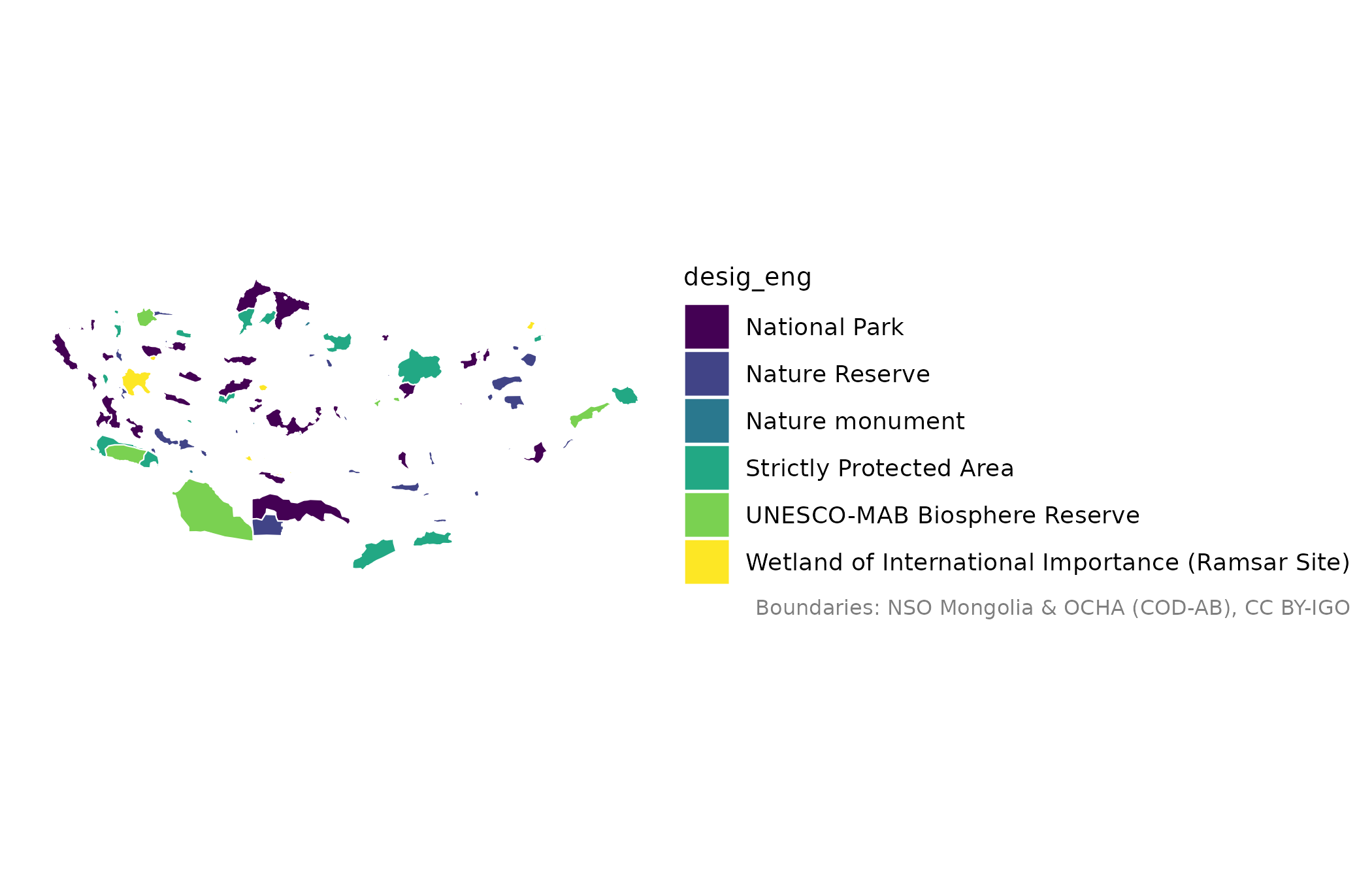
National parks, nature reserves and other protected and conserved areas of Mongolia from the World Database on Protected Areas (WDPA). The data are downloaded from UNEP-WCMC the first time and refreshed after 90 days; they may not be redistributed, so they never ship with the package.
Arguments
- within
Keep only areas inside these places (names or codes).
- refresh
If
TRUE, download again now.- crs
Coordinate reference system of the result.
NULL(default) keeps longitude/latitude (EPSG:4326). Use"albers","lcc"or"utm"for a projection suited to Mongolia (seemn_crs()), or any value accepted bysf::st_crs().
Value
An sf tibble with the WDPA attributes, including name_eng,
desig_eng (designation), iucn_cat and status_yr.
Terms of use
UNEP-WCMC and IUCN, Protected Planet: The World Database on Protected Areas (WDPA), Cambridge, UK. See https://www.protectedplanet.net/en/legal. The WDPA may be used for non-commercial purposes with attribution; it may not be redistributed.
See also
Other thematic layers:
mn_neighbours(),
mn_roads(),
mn_settlements()
Examples
pa <- mn_protected_areas()
#> ℹ The WDPA is for non-commercial use with attribution and may not be
#>   redistributed; see `?mongolmaps::mn_protected_areas()`.
#> This message is displayed once per session.
#> ℹ Downloading Protected areas (WDPA); this happens once.
mn_map(pa, fill = desig_eng)